Friday, 29 June 2012

29th - Trient – Chamonix

Today, coming back to Chamonix was a relatively short day.

After getting lunch at a supermarket we left for what would be the last day on the trek.

The plan was simple enough; ascend to Col de Balme and from there descend to Montroc in the Chamonix valley from where we would have a 20 minute bus ride back to the hotel. Simple as that! Well, did I forget to mention the 1000m ascend to the Col with same weather conditions as yesterday?

It was a tough walk, no doubt, but when we finally arrived at the Col early noon we had a magnificent view of the valley and Mont Blanc (unfortunately clouds where covering the summit). The Col was also the border between Switzerland and France. Here we had our lunch break, a comfortably long one, even. Afterwards we did a brisk descent; the knowledge that the hotel was not very far probably added a little to the speed.

Even if it meant that the trip was over, it was nice being back to the hotel; Wi-Fi, real showers and real beds. Despite everything it felt good being back.

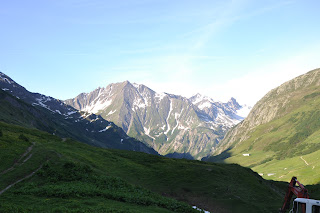
Morning view in the Alps.

Jules enjoying his lunch.

Our guide working hard.

The view from Col de Balme with Chamonix in the middle.

Mont Blanc

Thursday, 28 June 2012

28th - La Fouly – Trient

Today was really, really hard.

With that out of the way I can start from the beginning.

The day started as usual with breakfast and lunch packs and we soon left to ride a bus for app. 20 minutes. We had a gentle walk of a couple of hours before arriving in Champex. A small town, but it had a nice small lake at its center where we chose to have a break. The town was surrounded by mountains making it feel like it was completely isolated. From here we were told it would be a walk with gradual ascents and descents with a walk along a traverse with beautiful views. The part with traverse and views was correct. The other… not so much.

We fairly quickly ended up in an ascent that consisted of walking on rocks, preventing us from getting any steady rhythm going. On top of that it was at times very steep and also, as we were walking through a forest and the temperature was rising, it was very humid. After a couple of hours like this we finally made it to the top – or rather it opened up and got much less steep. We had reached the path called Bovine Way, one that went through beautiful grassy meadows and hills.

After a couple of much needed breaks (one including a delicious carrot cake!) we continued and descended down along some very steep paths.

We finally arrived at our destination in Trient. Here we were finally able to get some real resting going after the day’s walk.

Gotten a couple of blisters too, today. Crap.

Break in Champex

The lake in Champex

Lunch break before the big ascent.

A view from the Bovine Way

Pink(!) church in Trient

Accomodations. Despite being on the floor there were absolutely no problems falling asleep after today...

Wednesday, 27 June 2012

27th - Rifugio Bonatti – La Fouly

Despite the threatening clouds yesterday we had a clear sky when wakening up this morning and the forecast for the rest of the trek seemed promising.

After the usual morning rituals (breakfast, buying lunch packs) we were off; we descended down to the bottom of the valley (Val Ferret), and after a short break we began working us upwards to Grand Col Ferret (2537m) which also indicates the border between Italy and Switzerland. Half way we had a short stop at Refugio Elena.

After our lunch break on the Col we started a long gentle ascent down to Hamlet of Ferret (1705m). A short break later we continued down to the Swiss Val Ferret, taking us through the village of Ferret and finally to our destination, La Fouly.

A nice place (cramped sleeping quarters, though) with a great dinner. And Wi-Fi. Woo!


Tai Chi in the morning.

A break in the bottom of Val Ferret.

On the way up to Rifugio Elena

Border between Italy and Switzerland. Italy to the left, Switzerland to the right.

Swiss flowerpot.

Arriving in Switzerland, in the middle of rolling green hills and flowers.

Tuesday, 26 June 2012

26th - Courmayeur – Rifugio Bonatti

Having had the rest day was apparently enough for the body to believe that it was all over so getting moving again in the morning was harder than expected.

But away we went and we started off with a steep ascent to Rifugio Bertone at 1970 meters, overlooking Courmayeur. As the day was to be a short one we stayed here for a while, just relaxing and enjoying the view. Continuing on we followed a balcony path facing the Mont Blanc range, but today unfortunately the clouds were hanging quite low, preventing any chance of getting a decent shot.

A quick lunch break later we continued on, now with the occasional drizzle. It was a lot of on and off so it was hard for us to figure out whether to put on or take off our water proofs. I think most of us ended up putting it on and taking it off 2-3 times before arriving at our destination.

At app. 1430 we arrived at today’s destination, Rifugio Bonatti, a huge gite overlooking the Italian Val Ferret.

Now we’re just killing time, playing some games and hoping that the clouds will clear so some decent shots can be taken. Please?

Looking down on Courmayeur

a-HA! Danish influence!

The Mont Blanc tunnel. We found out that for 16 euros you could take a bus and go through and end in Chamonix in 40 minutes.

Lunch break.

The dorms. It all seemed very new and nice.

Monday, 25 June 2012

25th - Courmayeur

Today was a rest day and after a good night’s sleep a few people from the group got together and went into Courmayeur. Relatively quickly we found a bar with Wi-Fi. We mixed it up a little with walking around in the center of town having lunch and finding a crepes place, but we tended to end up in the bar afterwards every time.

After this obviously very tough day we came back to the hotel for dinner.

I have a small feeling that the next couple of days might get a little harder than this. Just maybe…

Sunday, 24 June 2012

24th - Vallée des Glaciers – Courmayeur

Waking up we were greeted by a cold morning; situated in the bottom of a valley the sun wouldn’t reach the gite until later, and at that time we were already on our way to our next destination.

Fun fact; despite now being in Italy, the gite we stayed in was owned by French. There has been no indicators that we have crossed into another country.

We soon reached Col de la Seigne (2516m) from where we had a great view of the valley we were aiming for. We had lunch at Rifugio Elisabetta which consisted of lunch packs bought this morning. Despite the unimpressive breakfast the lunch was actually OK.

Afterwards we continued downwards where we soon had the choice of taking a flat and easy route, or taking a high path which would give views of the Mont Blanc range. By democratic vote we took the high route which started off with a steep ascent and leveled off with a gentle descent. On the way down we had to cross several steep patches of snow – some of them more interesting than others.

Finishing off with a short drive we ended in Courmayeur at a beautiful hotel with just as beautiful views of the surrounding mountains.

Tomorrow is a rest day so we will be spending the day relaxing in Courmayeur or whatever we decide to do.

I apparently suck at applying sunscreen. Standing in the hot shower my skin did in some places feel slightly… sore.
The view from the gite in the morning.

Looking down on the gite, 40 minutes after departure.

Marmot. There were quite a few of these, and this crossed the path just as I walked by.
  
Standing at Elisabetta looking down into the valley we were heading to.

Probably the hardest crossing on the trek; steep snow and a very not so well defined path.

After struggling with getting across it was depressing to afterwards see a guy get his bike up on his back and just wander across.

Domesticated north-norwegian wolf (I think it was). Beautiful, but you always had the feeling it was checking you out. Amazing eyes, but just by looking at you you got the urge to check if you still had all fingers intact...

Saturday, 23 June 2012

23rd - Nant Borant – Vallée des Glaciers

This day will be remembered for two things: we met there bikers on the trail (crazy bastards) and an amazing chocolate cake for lunch.

We started the day with a simple breakfast before leaving at 0800. The plan of the day was to ascend app. 1000m from the 1500 meters we started and then descend again app. 900 meters.

We ascended on snow, making process slow but with a nice variation from yesterday. We crossed Col du Croix du Bonhomme, and at some point when descending around 100 meters to Refuge de la Croix du Bonhomme we crossed the border to Italy. Here we had our lunch; delicious pasta and an amazingly big piece of chocolate cake with raspberry jam. Yum!

High on sugar the next 800 meters down did not lack any energy at all, though the thighs and calves were beginning to be a little sore.

We were supposed to spend the night in Les Chapieux, but as they had run out of space we were transferred to Refuge des Mottes in Vallée des Glaciers. We were sent there by car, a pleasant piece of luxury, cutting off 5km of tomorrow, the trek’s longest day.

Yesterday my body tried convincing me going back home to my sofa. Now it seems to have understood that that isn’t an option and now just keeps moving forward. Must be a good sign. Still hard work, though.

Can't get tired of the view...

Getting ready for walking on the snow...

On our way...

Col du Bonhomme.

Biker!

Sleeping quarters.