Sunday, 20 July 2014

20th – Black, white, wind, snow.

We were woken up at 2330 where we had a quick breakfast before departing for the summit. The weather was great; we could see stars and the moon was clear.

The plan was that we further up would have 2 rope teams. These would require a guide in the front and back which meant that we needed 2 more guides than the primary and assistant that we had had until now. One of them came from the kitchen, a small guy from Nepal (who travel back and forth in the Himalayas to take kitchen/tour work in accordance with seasons) and another one, also Nepali, who had 8 8000m-summits under his belt so far. He was put in front but after having ascended the first 200 meters he was swapped with our usual guide so that we could get back to a more… reasonable and human pace.

We passed ABC and continued up along the glacier in absolute darkness apart from what we could see from our headlamps. We crossed over onto the glacier, and after having walked a bit further the glacier got so steep that we were put together on the two ropes. An incline of 40 degrees would not be a bad estimate as we slowly zig-zagged upwards.

At this point the sun started to give light but what we quickly realized was that we just went from darkness to white. The visibility was down below 100 meters which wasn’t overly impressive, and it didn’t help much that the winds had picked up and it had started to heavily snow.

Still ascending we switched our poles with our ice axes due to another increase in steepness. Also, what had until now been a surface of pure snow and ice had now turned into ice/snow and rocks which we had to scramble across. While this could be intensive enough for my tastes with the rocky nature mixed with crampons, whiteout winds and snow/hail it was still just a warmup of what we would be facing on the ridge. Still app. 300 altitude meters from the summit we were to scramble our way on the narrow ridge with drops on both sides and the weather unchanged. We had some quite narrow parts we had to get by to get closer to the summit and it got a bit hairy at times, despite being tied together.

At one point near the top we saw some of the guides stick their heads together, discussing whether or not the weather was too bad to continue. Luckily, they seem to agree that it was still not bad enough to turn us around (though apparently bad enough that they had to discuss it…).

At 0835, in snow and hail, horrible visibility and high winds we reached the summit, exhausted. The summit was quite small, almost a long and narrow platform. There were snow piled up on both sides, but with the soft rounding of the tops you were actually not able to see where they started and ended due to the massive whiteout so people stayed carefully in the middle. After only a few photos we were on our way down again.

We were going the same way as up which meant the rocks had to be crossed once more. When descending the weather started improving; it stopped snowing and the winds eased up. This meant that you occasionally got a view out on the surrounding mountains on the way down, and what you were able to see was amazing: Huge rock and ice walls and beautiful mountains all around. The clouds were moody, though, so a view one moment could be gone the next. Too bad the weather wasn’t good enough on the top as we could potentially have ended up with some great shots.

We all made it to the summit, and we all came safely down again, though one needed to be assisted down quickly half way down by the guides due to not feeling well at all. Apart from that we all came through scot-free.

I was back in base camp at 1400 as one of the two last in the group with sore feet and thighs but not really caring. The scrambling and weather made the climb more technical than I had mentally planned for, but in the end it was still a success. It is a new personal record for me altitude-wise; last one was Kilimanjaro with 5895m which was beat with more than 250 meters. It is now 6153m, I wonder what should be next?

On the way to the summit. Photo taken by Bo Belvedere Christensen.

Summit! Photo taken by Thomas Jul Andersen.

On the way down again along the ridge. Photo taken by Thomas Jul Andersen.

One of the lucky shots through the clouds on the way down. Photo taken by Susanne Irvang Nielsen.
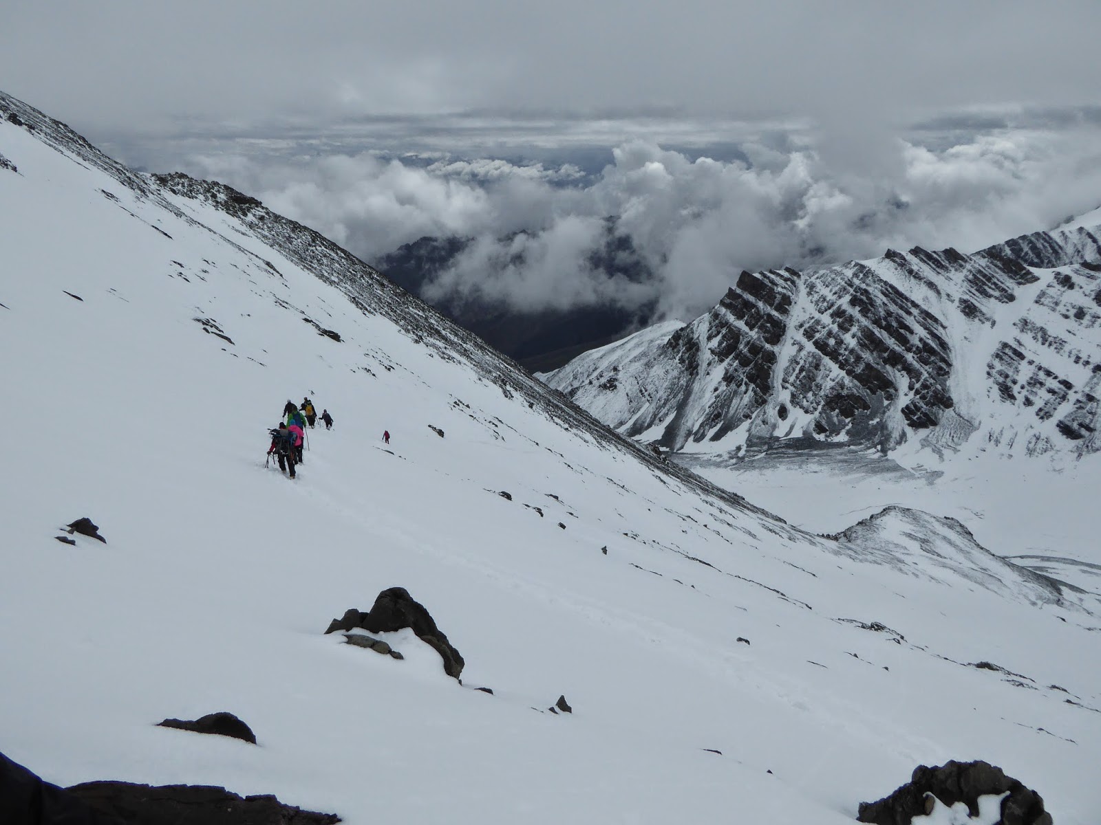
On the way down. This isn't even the steepest part. Photo taken by Susanne Irvang Nielsen.

Saturday, 19 July 2014

19th – Do you know your ABC?

Today the program was an acclimatization walk with glacier training and return to base camp before lunch followed by resting and restitution before the summit attempt at (around) midnight.

The day’s walk would bring us up to 5300m and Advanced Base Camp. Unfortunately it is not allowed anymore to camp at ABC as they got tired of the large amount of trash being left there (though some might also speculate the more people at ABC the fewer at BC where there is a small kiosk where you can buy a small selection of snacks and drinks which would result in a hit at profit). Too bad, actually, as the 400 meters head start towards the summit would have been helpful.

Arriving at ABC we reached the glacier we will be traversing towards the summit. Here we were introduced to self-arrest techniques (extremely basic compared to what we were taught on Elbrus) and introductions to how to react when someone on the rope you are tied to slips/falls.

We came back to base camp at around 1230 where we met the Topas group (Topas and Kipling (who I am travelling with) are basically the two big Danish travel companies that do trips like this) who is doing the summit push the night after us. We had a small talk with them and out of the group of 14 originally they have already lost 2 on the way to base camp. Let’s hope for them that they won’t lose any more on the way to the top. After lunch it was purely relaxation until dinner which was served earlier than usual, and then straight to bed.

Rumors spread quickly; the wounded tourist yesterday hadn’t been as wounded as feared; apparently he hadn’t broken anything. When falling he had apparently panicked and froze, not being able to move or get up, which some people had concluded being broken body parts. Good to hear!

Looking at the weather it seems to be clearing up. The last couple of days we have had overcast with the occasional drizzles (which at BC has been snow). On today’s walk we had snow most of the time and clouds not much higher than where we were. If the weather clears up for the summit attempt we will be getting some great views – potentially including a view of K2 if we are lucky.

We are 200m above BC on the way to ABC. The ridge seen going up behind BC is the one we went up yesterday.

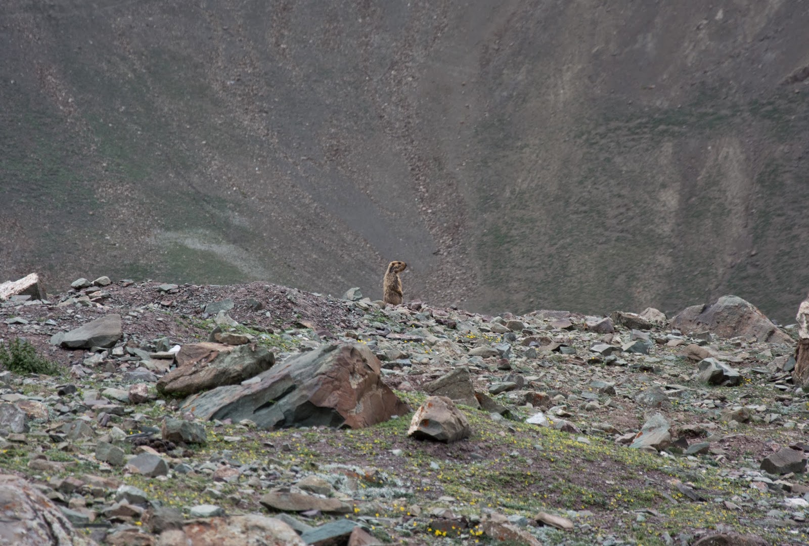
One of the many marmots in the area.

Friday, 18 July 2014

18th – Base Camp

We left camp at normal time despite only having a short schedule for the day which consisted of ascending 500 meters to base camp at 4900m. We arrived at around 1100, keeping to our normal pace of app. 200 m/hr.

Settling in the camp we noticed 3 helicopters circling the area. Rumors had it that a tourist had fallen and broken arm and back, but he had slid down to where the helicopters couldn’t reach him so people were working on trying to bring him to somewhere we they could reach him. After a while the helicopters disappeared and there was very little information to find.

After a short break a few of us together with Bo decided to do a small acclimatization walk on the ridge opposite Stok Kangri. As we didn’t have the “normal” guides with us we approached the ridge with a more liberal speed. When we hit the 5100m mark 2 people turned around – the altitude was getting to them – while the rest of us (3 + Bo) continued. We ended up stopping at 5300m, flying past the summit of Mt. Ararat in the process. We did it in 1:03 – which was double our normal speed. It felt good being able to have ascended that much in so short time, but I must admit I prefer the gentler pace we usually have. It took us 20 minutes to get back down.

The rest of the day was spent relaxing and for those not having it done before getting their crampons fitted on their boots.

This is the highest I will have ever slept – the last record was from Kilimanjaro, but base camp/Barafu camp there is “only” at 4500m.

Stok Kangri as seen from 5300m.

Enjoying the view at 5300m.

Stok Kangri and base camp in the same photo. It isn't even that far! 
The paths you can see going left and up from BC is the path to go when going to ABC and/or the summit. Where it reaches the ridge and goes behind the edge is 200m above BC, 200m below from where we are now.

Thursday, 17 July 2014

17th – The walk of passes

The morning started as usual with the exception that we from the very beginning prepared ourselves for rain on today’s walk.

We started following the path we had taken yesterday for acclimatization but when reaching yesterday’s stop we kept going up towards the pass. After a slow but steady ascent we reached the Stok La pass at 4900m. During the morning it had been raining on/off but at this point it had turned into a more continuous pour with the occasional mix of hail. From our elevated location at the pass we could see the path continuing down and up crossing the next pass before disappearing from sight. After a short break and enjoying the view from the Stok La pass we continued towards the next pass in line and when we reached our lunch spot we had crossed 4 passes after Stok La of decreasing height. What didn’t decrease was the rain, but around the last pass, half an hour before lunch, it suddenly stopped and we almost managed to get completely dry before eating.

The views were astonishing; sharp teeth-like cliffs cutting through the landscape, green surfaces all over the place and a cloud layer that gave it all a bit of magical touch. Often you just couldn’t help but stop and look around trying to convince yourself that it actually was real.

After the break we continued ascending up to 4400m at Mankarmo camp where we ended the day’s walk at around 1400. From there on the rain was occasional and unpredictable, but (as of this writing) never of the amounts that we encountered during the day’s walk.

Tomorrow is base camp at 4900m!

I must confess that I have been using my previous Elbrus trip as mental preparation. This trip has been physically easier than I had expected (summit day will remember that comment and kick my ass). This was the first tough day, and yet we arrived at camp at 1400. Compared to Elbrus that would have been a relatively short and easy day. Most of our afternoons have been quite lazy and inactive and part of me feel that we could have spent them on something. Don’t get me wrong; I love being lazy and doing nothing (especially with those views!), but as those having planned this trip have done it before and know what works I guess the comparison is unfair as the two treks/climbs are of different constructions. Also, on Elbrus we had to be built up from 1000m to 5600m, whereas we here start at 3500m (Leh) before ascending to the summit at 6153m. Maybe I should just stop worrying so much and enjoy the downtimes and views.

I love my Haglöf G-1000 pants; they were completely soaked and one point today, but within half an hour without rain they were back to being nice and dry!

I am less impressed with my North Face shell. The surface treatment given to prevent water from soaking through works as well as a gas cooker without gas. I have washed it several times with special surface treatment and sealant but it seems to wear off after a couple of weeks. Luckily the Gore-Tex membrane prevents the water from reaching all the way through to me, but I can’t say I am fully satisfied. Especially not considering what you have to shell (….) out for these things.

View from second pass. We came from the left side.

Looking towards one of the previous passes.

View from the last pass in the direction where we are going.

Reached the camp site and looking back at where we came from.

Wednesday, 16 July 2014

16th – Cloudy with a hint of marmots

The day started as usual with the exception of the weather being overcast with some heavy clouds here and there. We started gently ascending some 100 meters to Rumbak village where we got the chance to see how a normal house here looks from the inside. We visited the guide’s sister’s husband’s father where we got to taste butter tea and chang. Chang is basically home brewn beer and it is never know how strong it is so some caution is usually necessary when having a drink. The butter tea didn’t win any prizes and the chang, well… I’m not a fan of that, either. Smelling the contents in a small glass I was reminded of a yeast/water mix you start off with when baking.

There are 9 families in the village and three sources of income; guesthouses, camping sites (like the places we were staying at) and farming. The families are split into groups of three and each group gets the income for one of the three sources. Every year the groups rotate so that the split of money coming into the community is as fair as possible.

We continued our walk and after ascending to 4260m we reached the next camp, but to do some acclimatization we kept going on tomorrow’s route towards the Stok La pass, but stopped and had our lunch break when we reached 4400m. After the break we turned around and went back down to our camp where we arrived at around 1300 and had the rest of the day off.

Up to late afternoon the overcast held its grip which meant we had the occasional drizzle. Coming back to camp we had some actual showers but they were only short-lived which made them relatively easy to avoid. Late afternoon the sun managed to cut through the clouds, but it wasn’t long after it set behind the mountains.

Sitting in the dining tent during the afternoon we were able to see marmots in the distance, and by the looks of it it seemed to be a whole family/group.

Our host.

Tuesday, 15 July 2014

15th – Lord of the Flies

This is becoming a luxurious trip – you know, apart from the high altitude and walking by ourselves. At 0630 we were woken up with cups of tea, at 0700 we were given hot water for washing and at 0730 breakfast was served. At a bit past 0800 everything was packed and we were ready to depart. The staff packed the camp and followed later with everything loaded on the horses.

The day’s walk was relatively short – only 2-3 hours – but we ascended up to Rumbak at 3750m. The walk itself wasn’t too hard, but with several water crossings with only the occasional bridge there was plenty of chances to get wet feet.

Arriving at Rumbak we had our lunch break before having a 3 hour acclimatization walk up to 4100m.

Apart from that we had another relaxing afternoon.

While the camp is nicely located, we are seeing quite a large population of flies. I had thought/hoped that bugs wouldn’t have been an issue at this altitude, but it seems as if we have to cope with them some more yet. Either that or we are already more rank than we are aware of.

The acclimatization walk to the one house village.

Location of our camp.

Monday, 14 July 2014

14th – The Walk Begins

With an early start from the hotel we were picked up at 0730 with all our luggage and daypacks and were driven to Spituk just outside Leh. The girl who was sick yesterday felt much better this morning but to avoid overexertion she got a ride to today’s campsite together with our luggage.

The rest of us had a relatively short day ahead of us. We were to walk app. 5 hours along the road before reaching our destination which was Zinchen camp at 3200m. While it at the beginning didn’t feel as charming as one might have hoped to just walk along the paved road through the landscape we soon put villages and constructions sites behind us and found ourselves walking on the road with tall cliffs surrounding us, following the river Indus.

We had been picked up at the hotel early to avoid the high temperatures of the day, but when arriving at around 1300 at the camp we could still agree that it had been very hot already. Luckily most of the time breezes were able to decrease the temperatures to a tolerable level, but at soon as be made a turn or somehow came out of the wind it was obviously it suddenly got noticeable warmer.

The afternoon was spent relaxing. The camp site is an established one so a few groups arrived during the day. No problems whatsoever, but the amount of pack animals (horses and donkeys, and probably the occasional mule) was surprisingly high. But we are a group of 11, 12 (!) helpers (2 guides, cooks, kitchen staff, animal handlers etc.) and 23 animals, so if the other groups are similar the numbers of animals quickly increase. The interesting thing was that we saw a lot of animals but not near enough tourists to justify them, so it seems that the site is used for parking while tourists camp somewhere else.

Funny thing; before dinner we were all handed a brand new roll of toilet paper. I wonder if it is because they don’t have faith in their own cooking, but I hope it’s just to make sure we have the necessary remedies for when we have the need/urge. Always prepared!

The river Indus.

Freaky rock formations.