Saturday 28 July 2012

28th - Going home

The 27th we left the hotel in the morning – despite having been drinking generous amounts at the dinner last night everyone made it to breakfast at 0700, though some did look quite hung over.

3 hours drive to the airport, checked in the luggage all the way to Copenhagen and we were soon on our way to Moscow. Arriving in Moscow we were as last time taken to our hotel by bus. The difference this time was that we arrived relatively early so after a quick dinner at the local mall we took the metro to the center where we had a walk on the Red Square and around the Kremlin before finding a place where we had a couple of drinks. Back at the hotel at 2230-ish.

Next early morning we returned to the airport and without further ado (we were checked in all the way so it was straight to the security check bypassing the queues at check in) we went through the tax frees, got the mandatory amounts of vodka, and flew home and arrived in Copenhagen as planned at 1130.
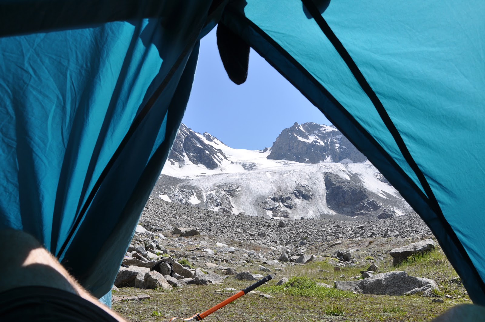
It was a great trip, considering how lucky we were with the weather. Some rain one night when camping and otherwise high sun and dry, and not too cold when climbing the summit. Aeroflot’s planes were of surprisingly high standards; they were all very new, not at all like the stories you hear of planes almost falling apart and rattling all over. A big thanks to our tour guide, Jakob, and local mountain guide, Max, for bringing us all around, up and down without problems. Thanks to the assistance guide (Ishmael), the cook, and the porters for carrying tents and food. Thanks to the entire group for being such a fantastic group – it wouldn’t have been the same without you.
Great trip, very memorable, but has made me change my mind about having plans of climbing Aconcagua (6959m, tallest point in S. America) in January/February in 2014. Maybe something smaller instead. Maybe Mont Blanc next summer. We’ll see…

The Red Square with the Kremlin on the right.

Lenin's mausoleum.

St. Basil's Cathedral.

Found at the Red Square's metro station.

Found at the station at our hotel...

... and this, too.

Thursday 26 July 2012

26th - Day 13

Today we left Diesel Hut and began our trip home. In the morning we left the hut and walked down to the lifts which we took down and got picked up by a couple of busses. At 1130 the first group was back at the hotel, enjoying a hot shower and comfort.

Lunch at 1300 and otherwise just relaxing, walking around, getting some drinks and trying to have patience with the hotel’s not quite so stable wireless internet.

Tonight at 1900 we will have a farewell dinner at a nearby restaurant; stories from the former groups indicate it will be a very happy evening. Apparently bottles of vodka will be available from the start and we are 20 people getting together. This will be an interesting evening.

Waiting for the lift to take us down from the mountain.

Wednesday 25 July 2012

25th - Summit day

Out of 17 people in the group, 15 departed for the summit. We had extra guides so that we would be able to split up more, and easier go back with escort without risking someone would end up going towards the top unescorted.

We were split up in two groups; a fast and a slow one. The slow would depart at 0100, the fast at 0200. The goal was to try and get as many at the top at the same time.
I joined the slow group together with 6 others even though it meant getting up at midnight after not much sleep. Departure wasn’t as cold as expected, and we were soon off in the darkness. Physically it wasn’t too hard in the beginning as we knew the area and had been acclimatized to this altitude. Soon things did get harder – and colder. I started having problems keeping my toes warm and at one point I lost feeling in my right foot’s toes. I also started moving slower – much slower. When reaching the traverse on the eastern top things starting getting steep and speed decreased even more. The walk gave some beautiful views of the sunrise and colors that followed. This also included the shadow of Elbrus spreading out over the surrounding mountains.

At around 0815 we reached the saddle between the two summits and at the same time the sun had gotten high enough that we were able to have a break in the saddle in the sun. The saddle is located at the altitude of 5300m, meaning we still had 300 meters to go. We had a full view to the next very steep section of the path which was quite intimidating in my exhausted state. After half an hour’s break we started we started the last part of the walk – the steep ascent on the western summit’s traverse. It was tough, but the advantage was that the sun combined with the exercise warmed up my toes and feet again. After the steep part it flattened making it easier (but still very slow) to walk. After a final steep part (15-20 meters) we were finally on the summit at around 1030.

Despite being exhausted I still took in the view of the surrounding areas and it was breathtaking (maybe that was just the lack of oxygen, though). We spent 10-150 minutes at the top before starting our descent, and even though I could have been standing and enjoying the view all day I was quite happy to leave as it was pretty windy on the top.

Despite going down the pace was still pretty slow due to our physical condition. Coming back to the saddle we had a short break (sun, quiet and no wind) before continuing downwards. Going around the traverse and down the eastern lower summit (it is 21 meters short of the tallest point in Europe) we passed the steepest parts of the path. From here there was almost a slide worn into the snow which meant we could descend 300-400 meters by sitting down. Not always comfortable it was much preferred from walking all the way down.

We finally arrived at Diesel Hut around 1400, finishing the primary goal of the vacation with a 13-hour 1600 meters up and 1600 meters down walk.

Was it amazing? Yes. Was it beautiful? Yes. Was it horribly tough? Yes! Will I ever consider doing it again? Hell no!

At the top!

Max at the top.

View from the top.

Tuesday 24 July 2012

24th - Second day on summit trip

Today was a short day to be ready for the summit push tomorrow. The plan was a short 800 meter acclimatization walk for 4 hours, back for lunch and relaxation the rest of the day.

Diesel Hut is at 4080 meters and climbing to 4850 was hard work – but knowing that it would make the walk to the summit easier I didn’t mind at all. This also meant that we passed the summit of Mont Blanc which is at 4807 meters.

Coming back we had lunch and the afternoon was mostly spent on sleeping as much as possible. Dinner was early and soon most had gone to bed to try and get as much sleep as possible before departure.

The view from our return point.

Monday 23 July 2012

23rd - First day on summit trip

Today the last trip started where the end goal is to reach the summit of Elbrus. As we are staying at Diesel Hut the entire time and we won’t be doing much walking before arriving it was easy to justify to bring main pack for the usual stuff and my day pack for the walks we will be doing (and at the same time saving a lot of weight on these!). In this case the day pack was filled with the two 5-liter jugs I had bought as there is no source of water at the hut (except the snow, but it has to be cooked before use).

We drive to a small town at app. 2300m where we took two cabin lifts and a chair lift all the way to 3800m. It was a little peculiar seeing chairs coming up with nothing but a bag on it. (Fun fact; there are two parallel cabin lifts up to the chair lift. The each run every second day so only one is running at a time. Apparently the two lifts are owned by two different fractions of the local mafia, so doing like that they avoid any unnecessary competition and therefore conflict). When arriving with the chair lift the luggage was loaded onto a snow cat which took it the 200 meters up to Diesel Hut while we walked the distance. Arriving we occupied the dorm and a room for sleeping and we soon had found our places in the building. A tight fit but it seems OK – except for the fact that there is barely any ventilation, effectively boosting the temperature and humidity in the room.

After lunch we went for a small walk (300 meters up). The original plan was to stay at the high point for half an hour, optimizing the acclimatization, before going down again, but seeing thunder clouds gathering in the distance we were ordered down immediately as fast as possible. It is an advantage having a high 0-degree altitude but it means that despite we won’t be freezing (or it will be harder to) the high temperature gives us a surface that most of all reminds of slush ice. It’s heavy, but it’s only just around and above the hut for the first 400-500 meters, afterwards it ought to be cold enough to give a firm easy surface.

Tomorrow with be a relatively short day; 700-800 meters ascent and return being back for lunch, followed by an afternoon where we do as little as possible before departing to the summit in the night. It feels weird that we have returned from the summit in less than 48 hours.

Getting into the first cabin lift there was a lot of attention directed towards what looked like a bullet hole in both ends of the cabin.

3 people in the group decided to walk all the way up without using the lifts - here escorted by a guide.

Food arriving by chair lift...

... and also our bags.

Diesel Hut, the dorm. 

Dusk at Diesel Hut.

Dusk panorama at Diesel hut.

Sunday 22 July 2012

22nd - Last day in second trip

We woke up to a windy and cold morning. The sun was hiding behind the hills, not being able to give us the warmth we have gotten use to the previous mornings.

Packing up went like a breeze and we were soon on our way. The plan was to descend 300-400 meters in 2 hours and these were fairly eventless. Around 1000 we arrived at our destination for a round of beer/soda/something else and pickup back to the hotel at 1030. Time for a very much needed shower!

The next couple of days we will spend the nights at Diesel Hut at 4000m where we will acclimatize before the push to the summit on Wednesday. It will be interesting – the walk will be all the way from the hut which will mean an ascent of 1600m – and of course followed by an equal descent. We will apparently leave around 0300 and no matter where we are at 1300 we have to turn around to make sure we will make it back to the hut before it gets too late. The weather forecasts are optimistic; including the wind-chill factor the top has temperatures of app. -10°C and the zero-degree altitude is around 5000m. It’s better than a summit temperature of -35°C which is the case now and then, but it also means that the conditions will be wetter, and therefore heavier.

A short break, overlooking the town where we will be picked up within the hour.

Saturday 21 July 2012

21st - 4th day in second trip

The day started as usual with packing the camp and at 0800 we had departed. The goal today was to ascend 700 meters before descending 1300 meters to our final camp on this trip.

The first few hundred meters of the ascent was on rocks before reaching the glacier that was to bring us to the saddle we were to cross before descending. At the glacier we hooked up all our equipment and we started working us upwards the glacier. In the beginning it was mostly ice so it was easy to see if there were any cracks to avoid. Half way up there was too much snow to see the condition of the ice which meant we got tied together, and slowly we continued. People had a few issues when walking like this with regards to the rope, but finally – without incidents – we made it to the saddle, called Irik Pass. It is probably worth mentioning that the porters just walked up the glacier in their daily shoes and now safety rope.

After a short break we continued downwards; steep dirt and gravel (a little like the second day of this trip) but there were a lot of rocks sticking out so it wasn’t able to get a constant sliding going. Afterwards we crossed a patch of snow; it was much easier just sitting down and sliding all the way than walking – that cold sensation afterwards was the missing waterproof pants.

We had a short lunch break after which we just kept going down and down on rocks, gravel and dirt/growth. We ended up in a nice green valley which we followed for a while before reaching our campsite located on a platform/hill overlooking the surrounding area. Later in the evening clouds came rolling over and visibility dropped dramatically. Seeing the surrounding mountains disappear and temporarily reappear from the clouds was almost magical.

Tomorrow we will be walking for 2-2½ hours and descending app. 300 meters to 2200m before being picked up by our busses and driven back to the hotel. Here we will have the rest of the day off before departing on the trip that will bring us to the summit of Elbrus – if everything goes as planned.

Preparing for the glacier walk to Irik Pass.

After all the safety briefings it was weird seeing the porters without a single piece of safety equipment and in their sneakers, doing the same walk as us.

View from the saddle from where we came.

View from the saddle to where we were going.

The valley we were aiming for.

The location of the camp.

Friday 20 July 2012

20th - 3rd day in second trip

The plan was to start late, breakfast at 0800 and departure at 0900 which meant getting a good long sleep and still having time to pack everything before leaving.

We started with a 200 meter ascent before reaching a saddle where we had the option to climb one of the two small summits. A few stayed back and relaxed during the one hour it took for the group to go up and down.

Afterwards we had a very steep 600 meter descent on primarily loose gravel. It was relatively fine, despite a fall which resulted in a bruised (and now sore) knee and pride.

At the bottom we had a river crossing; the river had gotten too big so we had to take off our boots and cross in socks/sandals/bare feet. The water reached half way to the knees and was really cold (go figure, considering it comes from the glaciers) but all in all it felt quite good having the feet getting a rinse.

After half and hour’s time of following the river we had lunch after which we were looking at a 300-400 meter ascent. We were in a nice green area, but the path soon turned into rocks, but never as bad as yesterday (I doubt it will ever be as bad (unstable) as yesterday…). Turning a corner the narrow steep path with rocks on one side and a river on the other suddenly widened to a huge open area at the bottom of a glacier were we set up camp at around 1500.

Tomorrow morning we are ascending the glacier, 700-ish meters with full equipment (this included being tied together), before steeply descending 1300 meters. Due to the unpredictability of the stability of the snow bridges (snow gathering on top and covering the crevices in the glacier), which is why we are required to be tied together, the walk up can either be an easy walk of 2 hours or a long and exhausting of 5 hours or more. This has great potential of becoming interesting…

A view from the saddle.

Looking up from where we came from at lunch.

And looking down - not the way we were going.

The view from my tent opening - including a sock hanging from the roof, drying.

Thursday 19 July 2012

19th - 2nd day in second trip

The goal today was to climb 700 meters to reach the summit of Mukal (3904m), a summit close by the camp and then return back to the camp to spend the second night there. Sounds easy enough, right?

The first 400 meters were relatively easy; ordinary mountain growth and a couple of rocks, and later plenty of snow. It wasn’t difficult in itself, just hard work.

What followed was a mountain side filled with rocks of varying sizes (small and large) that were piled among each other and seldom being very stable. No matter how stable a rock (even a huge one) looked, there was a high probability that it would move, tip or slide if you stepped on it (or just looked at it) in a wrong way. Add to that that the path up was steep and you had quite the nerve wrecking scenario for a couple of hours.

We finally made it to the top; rocks were still not very stable, not too much space to move around on and steep slopes to all sides made me sit down and enjoy the view far away and trying to ignore our – albeit picturesque – crazy situation. Despite being “only” 700 meters at noon I already felt exhausted. This was the first summit of our trip, but probably also the easiest.

After a short while we started getting ready for our descent. Luckily we did not take the same way down as we did up (that would have freaked me out even more than I already was), but instead we followed the mountain ridge for a while. This was the usual conditions along a very narrow path with steep slopes on both sides. After 10-15 minutes we stepped off and moved down the side towards the snow we started on in the morning. Getting down from here was much more fun than expected. The surface was fine loose gravel which we used to our advantage; we all got into almost touching distance of each other and the just slid down all the way. Basically we ended up going down almost 300 meters by riding a small local rock slide.

Coming back down to the snow we continued down and half an hour from camp we had lunch. After this break we came back to the camp at around 1430 and simply relaxed the rest of the day.

The weather in the afternoon and evening was worsened by the increased number of clouds gathering and passing through the camp, and also more windy (lying in the tent now it seems to have stopped blowing, though). Everyone has been wearing more clothes than usual.

Tomorrow we are moving the camp. Mostly a short day with app. 600 meters descent and app. 500 meter ascent spread out. We will according to plan arrive at our new camp site shortly after lunch.

Looking down at the lake you can just see the camp on the left side.

A quick break before continuing after the snow. Notice the size of the rocks - that was how it was all the way up.

The view from the top of Mukal.

Our mountain guide Max and tour guide Jakob during lunch.


Wednesday 18 July 2012

18th - 1st day in second trip

It is probably worth mentioning the plan I originally put up on the blog is not being followed now. The reason for this is that one of the acclimatization walks was up to a summit which would require us to cross the border to Georgia during the ascent. And that is not the most popular thing to do these days.

We left the hotel in the morning around 0900 and were dropped off half an hour later where we began our ascent. We started going up along a steep gravel road, and after app. 400 meters we ended up in a valley which was a mix of ordinary grassy paths and actual rocks that had to be climbed over/across. We had a couple of much needed 10 minute breaks along the way but otherwise we were just moving along.

We had lunch around 1330, overlooking the valley we had walked up through. I had ended in the back together with a second guy as we were going slower than the rest of the group. Not a big problem, it felt comfortable going at our own pace instead of having to keep up with the rest that were walking slightly faster than we felt like. We had one behind us, though, who didn’t arrive at our place for lunch until the rest had continued. We found out later that he at that point had given up and had our assistant guide escort him back. At that point we had ascended app. 1200 meters.

After lunch there was plenty more rock climbing, but a couple of hours later we arrived at our camp site (“my” group which now consisted of me and two others arrived 10-15 minutes after the main group). This gave us in total a 7-ish hour walk, as opposed to the estimated 8-10 hours. So even if we have been slow, we still have kept up a good pace compared to the original estimates.

Since arrival we have set up camp and just relaxing. We can look up on the glacier we are walking tomorrow before coming back here. We are at app. 3200 meters and the walk up the glacier will be a 700 meter ascent.

We have a guy in the group who only has one leg, name is Lars. It is massively impressive seeing him going along – there is nothing that seems to worry him, and that says quite a lot considering the conditions here. When navigating glaciers he puts on spikes on his crutches and the head of an ice axe is mounted on one of them.

It is horrifically windy here right now – I am glad I can sit in our tent and not have to care. The sun is still shining so when the wind doesn’t find the one angle that lets it inside the tent it is comfortably warm.

[added later in the night]

It feels like the wind has gotten stronger – but it also seems as if there are more pauses, too. When the sun set far enough to leave our camping site in the shade of the mountains it suddenly got quite cold. But seeing distant mountains still covered in sun it is a beautiful sight.

At the end of the lake at the camp in the direction from where we came there is a small range of hills, creating almost a vertical wall on the other side. It’s almost hypnotizing seeing clouds get blown straight up before being dispersed slowly in the wind, making constant unique shapes and figures. Seeing a big dense grey wall of clouds coming up is intimidating until it slowly disperses in the air.

Looking down through the valley where we came from.

And looking up at where we were going.

The camp beautifully placed below mountains and glaciers next to a lake. 

The view from where we came.

Tuesday 17 July 2012

16th-17th - The walking begins

The way the trip works is that we use the hotel as a base and from there we depart on multi-day treks. The first trek has now been completed; 2 relatively short days where the main purpose was to learn how to navigate on glaciers will full equipment and self-arrest techniques (what to do if you fall and slide down a glacier/snow/ice).

We departed the hotel after lunch. In the morning we took a chairlift up to app. 3000m where we had an amazing view of the two summits of Elbrus. Elbrus is actually two summits; east and west, west being 21 meters taller and the top we are supposed to end up on at the end of the trip.

Departing after lunch we drove half an hour where we halfway had to go through a military checkpoint. This took 30-40 minutes as everyone in the group needed to be checked and compared to the information in our passports.

At our destination we had a 2 hour walk with a 400m ascent before arriving at “The Green Hotel”, a large green area in an otherwise relatively barren environment where we put up our tents. After this we had a leisurely walk along a moraine, overlooking glaciers and just relaxing taking in the views. Elbrus could be seen in the distance, covered in clouds. Coming back to the camp dinner was ready and soon people went to bed.

The next day they woke us up at 5 and leaving at 6 we set out to climb a nearby glacier to train walking with crampons and self-arrest techniques. This involved instructions on how to use your ice axe if finding yourself sliding down an icy mountain side. We came back to the camp at 11-ish where we packed up and had lunch before returning the same way from where we came, getting picked up by the busses.

This time going through the checkpoint was a breeze.

We were back at the hotel around 1500 and since then we have been doing as little as possible and getting ready for the next trip. This trip will be 5 days, tallest point around 3800 meters (we reach app. 3000m today). First day will be a long one; 8-10 hours has been estimated to climb a 1600m ascent. A really need to be looking into if anything can be removed from my backpack.

First morning, first view of Elbrus.

Camping site at The Green Hotel.

Group photo at the moraine.

Visitors at the camp.

First walk on a glacier.

On the way down, meeting the porters coming up to gather the equipment not carried by us.

Sunday 15 July 2012

14th-15th - Arrival in Russia

Despite being in a group of people I have never met before it was easy to find some of them at the airport; big climbing boots, and those who had checked in their boots came over to the increasingly large group of people gathering at the gate. I have never sent so much time and energy on looking at strangers’ footwear.

Arriving in Moscow after a delay and only 2-ish hours all 17 was gathered. A few nervous looks at the luggage belt as someone’s bags took a very long time to arrive but finally we all had received our bags, met with the local agent and spent an hour in a bus to get to a huge hotel where we were checked in for the night. Being late we just found a local place for dinner and went to our rooms.

We left the hotel early in the morning and went back to the airport to catch our flight to Mineral Vody. Here we met with our tour guide Jakob and were transported in two non-AC’ed minibuses for a 3-hour drive. The driver didn’t seem to care much about the speed limit and several time he had to navigate through herds of cows that had decided to stop and rest in the middle of the road. Checking in at the hotel (at app. 2200m) at our destination we had a couple of hours by ourselves before an introductory meeting and dinner.

Tomorrow will be a relatively easy day; we leave after lunch and have a couple of hours trek before reaching camp. We will go by bus in the beginning, though, and because we are so close to the Georgian border we will be passing through a military checkpoint, which apparently easily can take an hour to get through.

The day after will be significantly longer with walks across a glacier, getting altitude before returning to the hotel.

After this we will have another – longer – trek and returning to the hotel before going on the final trek that is to bring us to the summit of Elbrus. It makes it easier with packing as you only need to bring the clothes for those few days. And I have a feeling I will love any saved weight when starting the walks.