Tuesday, 24 September 2013

24th - Matate – unnamed camp

From the camp we start going to the pass Tizi Oudite before descending (again…) into the first berber village Ait Aissa. The berbers is the oldest people in Morocco and is found in Northern Africa. The word “berber” means “uncivilized” in Arabic (“barbarian”) but they use “Amazigh” (“free men”). They immigrated maybe 5000 years ago into Morocco where they primarily live from agriculture.

We continued on to Tizi Oussem which consisted of a lot of small houses built close together up along a mountain wall, giving it almost a claustrophobic feel when walking around. You often felt you were walking inside a building due to the narrow pathways and buildings been built up and over.

Departing the last village for the next couple of days we ascended 400m into a deep gully where there was a tall waterfall. From here we continued upwards, coming up into the open we had lunch under a small grouping of trees before we continued ascending almost 1000m to our camp site at app. 2900m.

The plan was that we were to camp on a large plateau/pass, but another group had already arrived and taken the spot. Instead we had to continue along the mounting side into a small corner where there was just enough room for the tents to be raised. We looked the direction of where we would be going the next morning and all we could see was a tall steep ascent to a pass which looked quite intimidating. On the other side of the pass – and therefore mountain we were camping up against – we would be able to see Toubkal close.

We also quickly realised that the wind was picking up and I can’t help think if it wasn't best that we weren't camping in the open which had been the original plan. Then again – it felt like the wind being channeled by the mountain straight into the camp so that being in the open might have been an advantage after all…

Tizi Oudite seen from the camp.

Looking down at Ait Aissa.

One of many goat herders. And goats.

A guy had set up shop selling tea and sodas. Obviously for tourists. But it was priceless sitting in the shade enjoying a cold soda while enjoying the view.

Gully and waterfall.

Ascending once again with the mules right behind us.

If you have problems seeing tomorrow's path I can inform you it goes up through the narrow light-grey wedge seen in the middle of the photo.

Monday, 23 September 2013

23rd - Tacheddirt – Matate

Departing the guest house in the morning our path brought us through the entire length of the village before exiting and getting out in the open barren environment again. We followed a small gravel path along the mountain sides with a slight descent which brought us through a couple of smaller villages in around 1600m.

Walking the path from one point to another here we are mostly by ourselves. When we meet others it is usually porters (i.e. mulers), other tourist groups or goat herders.

From here we started ascending again, bringing us up to the pass Tizi n'Aguersioual where we could look back at where we had come from, and ahead of us look down into the Imlil Valley where we were going (and further away around a corner where we had started the trek) and the plateau further ahead where we would be concluding the day’s walk.

From the pass we descended (again) into the valley where our guides brought us down to a riverbed which during spring would be filled with water but now only had a slight trickle. Here we had lunch and we were told that if we took the road the opposite direction of what we were supposed to we would end up in Imlil after a handful of kilometres. Basically our starting point was fairly close to Toubkal, but we would be circling around in a spiral movement, slowly closing in on the mountain throughout the trek.

After lunch we continued on our way, and the plateau we could see from the pass was now the last goal of the day – app. 800m above us. The ascent was gentle, though, so we didn’t have to worry about having to face an unbearable steep trek. The first part we mainly followed a road upwards, giving us a nice view of the alley as we ascended. At this altitude there ware trees and other green areas as on the first day, but it wasn’t long before we reached the tree line and came back up in the barren areas. Here we left the road and took a more or less obvious path further up before we reached our camping ground. Just a handful of meters above us, at 2200m, the pass Tizi Oudite could be seen, the first point of the walk tomorrow.

We had a great view of the valley and could watch the clouds roll into it, below us so we weren’t affected. And it was fun being able to look across the valley seeing Tizi n'Aguersioual where we were in the morning, looking at this exact spot.

Narrow streets in Tacheddirt (and all other villages).

Looking down into the first valley of the day.

Bottom of the valley in the middle of dried out riverbed (if the "dried out" part wasn't obvious by looking at the photo).

The view from Tizi n'Aguersioual.

Right after where we had lunch this sign was spotted.

The view from our camp, seeing the clouds rolling in below us.

Sunday, 22 September 2013

22nd - Imlil – Tacchedirt

Getting ready to depart from our guest house in Imlil after an amazing breakfast (which, as we found out, would more or less be the standard for the trip) we met with the rest of the staff and mules. Everything not part of our day packs was piled up on the mules, and away we went on the first day’s walk.

Imlil is located at app. 1740m, and from here the first half of today’s walk would be going up through forests and other green patches in the otherwise rocky environment. Due to the dry weather the locals have built extensive watering canals to distribute the water among the crops. The crops in these areas are mainly walnuts and dates.

Reaching the highest point of the day was the pass Tizi n'Tamatert located at 2279m. Here we had a short break where we had a nice view of the Imnane valley before continuing, now almost completely horizontally the next couple of hours until we reached our destination early afternoon, Tacheddirt, a village at 2314m. This is apparently the highest located village in the Atlas Mountains.

Arriving in the early afternoon gave us some spare time before dinner which we spent on walking around the village. Being an old and very simple village it consisted of very narrow pathways, with a cow here and there keeping an eye on us over the fence. It was obvious that the place where tourists were when staying in the village – the guest house we were spending the night – was by far the best building in the entire village.

Walking in the green areas. You can see the watering canal coming down in the middle and out in the bottom left corner. We saw plenty of these during the trek.

The view from Tizi n'Tamatert towards where we were going. Continuing along the road on the right side, ending up in Tacheddirt (to be found in the small green patch furthest away to the right). 

Beehives.

Tacheddirt.

The view from our guest house. The green area seen in the left side of the photo being split by a path was where we came from.

The view during the night.


Saturday, 21 September 2013

21st - Departure to Morocco

We were to meet at Copenhagen airport at 0400 in the morning to catch a plane 2 hours later. As the university had their annual party the night before and I was hired as a photographer at the entrance for a couple of hours, everything would fit nicely with me spending the evening and night at the university, go home around 0200, pack the camera into the travel bags, grab the train and be at the airport on time. Some might argue that some sleep would probably be in order, but considering how bad I am at getting up in the morning I was not willing to take the chance when the departure was that early. And despite the public transportation wasn't very service minded (had to announce that I would show up a little later as it was either that or arrive 2 hours early) everything went better than expected – even though I did feel a bit tired as the day progressed.

The flight to Morocco was eventless and a couple of hours’ flight later we arrived safely in Marrakesh airport where we were picked up by our guide. From here we drove another couple of hours out of Marrakesh down south toward the Atlas Mountains and the village Imlil (I might have slept most of the way despite the condition of the roads…). Here we were to stay at a nice guest house the first night of the trip. We started off having lunch on the rooftop before taking a walk through the village. A nice and comfortable temperature, the town was fairly easy to navigate; one main road, a couple of small roads to the side and a lot of small paths and alleys going out to the sides every now and then. Nice place, very relaxed despite regular flow of cars that wanted to pass by on the narrow road and the occasional other tourist now and then.

Came back to the guest house for dinner, and soon after it was bedtime to get ready for departure the next morning. That sleep was greeted with open arms.

Standing on the roof of the guest house looking down towards Imlil.

Looking up at a small grouping of buildings outside Imlil.

Sunday, 15 September 2013

14th-15th - Viscri, Brasov and home

In the morning we were up early for breakfast before three horse carriages came to pick us up to give us a ride through the village and show us some of the local industry.

First stop was an elderly couple who show us how they make charcoal. A lengthy process and not something I would ever want to try. Wood gets piled up and covered in dirt, the wood gets set on fire and then the heat has to be kept for 14 days. The charcoal is sold to people who bring it to Brasov and other places. Apparently they are renowned for the very high quality.

Next stop on the drive around was at the village’s fortified church. It was basically an old, relatively simple, church surrounded by a bulwark with rooms where people could live if necessary. We were able to climb up the tower of the church from where we had a relatively unhindered view of the surrounding area.

Last stop was a brick maker where we were introduced to the traditional – and still used – method of making bricks from digging out the clay, shaping it, drying and burning it. It was quite interesting and as they apparently are the only ones who supply the village with bricks they always had something to do. As opposed to the charcoal makers they only make bricks for the village, but as they are the only ones doing so they are always busy.

After some free time and lunch we were back on the bus and left for Brasov. When we arrived we got on a train to Bucharest where we said our goodbyes and found the hotels we had reservations at. My roommate and I decided to stay roommates one more night so we left for the hotel I had a reservation at, managed to upgrade to a twin bed room, had a quick dinner and relaxed in their bar. Nice and comfortable.

After getting up early I had a short walk near the hotel before we were picked up by our shuttle at the hotel to go to the airport.

The home flight went fine and all I could do now was to prepare for the trip to Morocco in one week.

The fortified church from a distance.

The pile of wood isn't even close to finished. In the end it'll be app. double the height.

Viscri from above.

The brick maker.

The oven. It was app. 2x3 meters, and the bricks are piled more than 2 meters high before being baked.

Friday, 13 September 2013

13th - Viscri

Early morning rise at the lodge before breakfast and walk down back to the bus. The bus didn’t pick us up where we had been left so this time we had to go down to the end by ourselves. Not too bad though, it was all just gravel road and the weather had improved since yesterday.

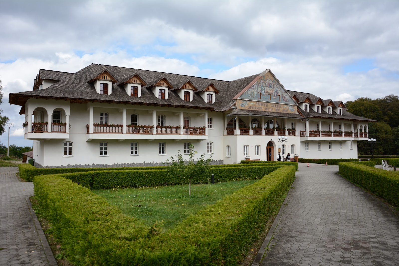
We ended up at Sambata Monastery where we had an hour to walk around and have a look. From here we took the bus to Viscri, a Saxon settlement. It is now a small village on the UNESCO heritage list with most of the original buildings still preserved. The owner of the place owned a few houses spread out in the village, so when they handed us our room keys we were split up into different houses.

In the evening we were treated with a traditional Romanian dinner with accompanying local spirits it turned into quite a fun evening.

Small waterfall spotted on the way down.

Monastery.


We saw this small thing wandering around at the monastery.


One of the many old houses in Viscri.

Thursday, 12 September 2013

12th - Moldoveanu/Sambetei

Today’s goal was to reach the tallest point of Romania, a path that would lead us from the lodge, up into a saddle and across 4 small summits before reaching the top, Moldoveanu peak, at 2544m. Unfortunately the weather hadn’t improved much since yesterday, so the clouds were covering the saddle, effectively preventing us from seeing where we would be going.

Almost half the group stayed back in the lodge while we made the attempt to get to the summit. It didn’t rain but the lack of sun meant that the ground was in areas moist and slippery. But up we went, and the further up towards the saddle we came the more rocky it got, so the moisture became less of a problem.

Standing in the saddle we realized that the weather wasn’t with us today. Visibility was less than 50m with light rain and high winds. But we wanted to see how far it would be possible to go, so we continued on over the first small summit. The weather didn’t really change and it was generally pretty sully. A small trekker’s hut was placed after the summit which we quickly entered to try and wait until the weather improved before continuing on.

We ended up spending an hour or so in the hut before deciding that we might as well be heading down again because there was no indication that the weather would improve. Back over the first summit, down to the saddle and down from there went without problems – the descent when nearing the bottom wasn’t near as muddy as I had feared due to the rain so the walk down ended up being easier than expected. And you couldn’t really complain about that.

So no, the tallest point in Romania was not reached; the altitude of the top we passed was around 2100m so it wasn’t too bad. But this was the first trip I have been on where the summit was not achieved, but I am glad that it was on this and not on some of the taller mountains I have been climbing.

Looking upwards in the morning it looks promising.

Looking down from where we came.

Weather changed, though.

On the way down towards the saddle, this is where we came from.

Looking down towards where we were going.