Getting ready to depart from our guest
house in Imlil after an amazing breakfast (which, as we found out, would more
or less be the standard for the trip) we met with the rest of the staff and
mules. Everything not part of our day packs was piled up on the mules, and away
we went on the first day’s walk.
Imlil is located at app. 1740m, and from
here the first half of today’s walk would be going up through forests and other
green patches in the otherwise rocky environment. Due to the dry weather the
locals have built extensive watering canals to distribute the water among the
crops. The crops in these areas are mainly walnuts and dates.
Reaching the highest point of the day
was the pass Tizi n'Tamatert located at 2279m. Here we had a short break where
we had a nice view of the Imnane valley before continuing, now almost
completely horizontally the next couple of hours until we reached our
destination early afternoon, Tacheddirt, a village at 2314m. This is apparently
the highest located village in the Atlas Mountains.
Arriving in the early afternoon gave us
some spare time before dinner which we spent on walking around the village.
Being an old and very simple village it consisted of very narrow pathways, with
a cow here and there keeping an eye on us over the fence. It was obvious that
the place where tourists were when staying in the village – the guest house we
were spending the night – was by far the best building in the entire village.
Walking in the green areas. You can see the watering canal coming down in the middle and out in the bottom left corner. We saw plenty of these during the trek.
The view from Tizi n'Tamatert towards where we were going. Continuing along the road on the right side, ending up in Tacheddirt (to be found in the small green patch furthest away to the right).
Beehives.
Tacheddirt.
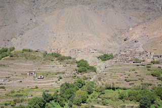
The view from our guest house. The green area seen in the left side of the photo being split by a path was where we came from.
The view during the night.


No comments:
Post a Comment